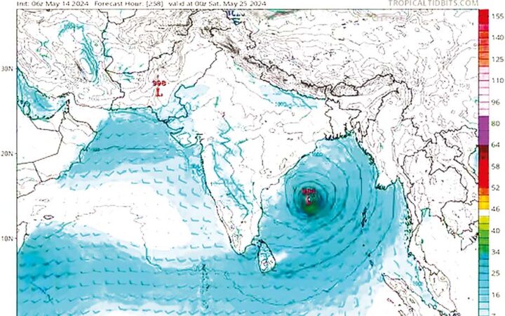
According to the forecasts calculated based on 14 May 2024 (18:30 Myanmar Standard Time) data of the European Center for Medium-Range Weather Forecasts (ECMWF) in England, the Department of Meteorology and Hydrology announced on the afternoon of 15 May that only low-pressure levels were found in the Myanmar Delta on 23 May 2024.
Similarly, according to the DMH-WRF Model’s estimates based on the time of 14 May 2024 (06:30 Myanmar Standard Time), atmospheric turbulence may begin in the southwest of the Bay of Bengal and the related central west of the Bay of Bengal around 23 May 2024. A low-pressure area may start to form on 24 May 2024.
On 25 May 2024, the low-pressure area will move to the northwest, becoming more vigorous, and it may move towards the coast of India and Bangladesh on 27 May 2024.
According to the estimates based on the Global Forecasting Model (GFS) data from the National Hurricane Centre of the United States of America for 15 May 2024 (00:30 Myanmar Standard Time), a low-pressure system may begin to form in the northern Bay of Bengal on 26 May 2024. It may move to the north and cross the coast of Bangladesh on 27 May 2024.
At this time, the low pressure has not yet started, and the predictions of the mathematical models are all dependent on the time of measurement and the data used. The Department of Meteorology and Hydrology will release the forecasts calculated in a timely manner, according to the statement. — TWA/KZL
Low pressure found over Myanmar Delta on 23 May
- May 16, 2024
- 93


